Although this panoramic hike in the Lötschental – Fafleralp to Lauchernalp, is not a secret anymore and is well known by many hiking enthusiasts. It is a classic, not to be missed hike when visiting the Lötschental in Valais.
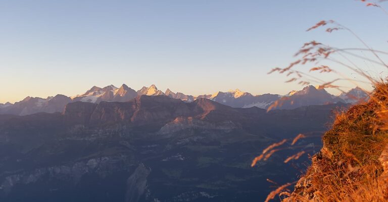
With panoramic views over the Lötschental and the majestic Bietschhorn it is another bucket list hike when in the Lötschental, Valais.
The whole valley leads you into a world full of tradition and it is called by the locals The Magic Valley for a reason.
Where is the Lötschental Panoramic Trail
This beautiful valley – the Lötschental is located in the Oberwallis in the Swiss German-speaking part and is the longest side valley on the northern side of the Rhone Valley. It is also called the Magic Valley. The Fafleralp area is part of the UNESCO World Heritage Site Swiss Alps Jungfrau-Aletsch.
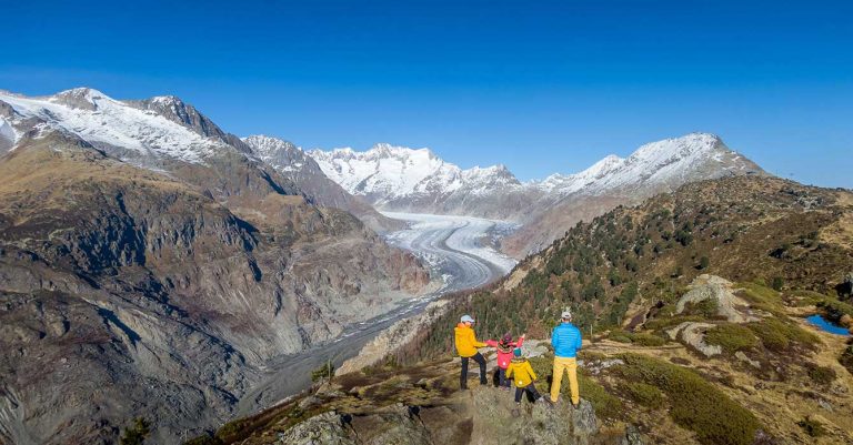
The heritage site lies in the Bernese Alps, with the Lonza river running down the length of the valley from its source within the Langgletscher. The glacier you can see when arriving at the parking place where our hike starts.
A stunning panorama trail goes all the way to Faldumalp Chapel and then down from the Faldumalp to Ferden (gradually sloping natural path) or to Goppenstein (rather steeper descent via Haselleen).
But we are showing you here only the well-known Fafleralp to Lauchernalp Panoramic trail.
Enjoy the Video of the Lötschentaler panoramhike.

What to expect on the Fafleralp to Lauchernalp Hike
As the name states, you will be honoured with an amazing vista along the valley and up to the beautiful Langgletscher glacier and the Bietschhorn.
NOTE – HIKING TIP!!
For an easier version of this hike with less uphill, do the hike in reverse and start at Lauchernalp! You will only have a max 140m ascent. This is also the original path.
Situated almost entirely between 1,750 and 2,100m above sea level, the Fafleralp to Lauchernalp – Lötschental Panoramic Trail offers a magical panoramic view of the Lötschental.
It quite quickly starts to climb gently all the way to Schwarzsee. The path meanders through wild romantic forests, and if you’re hiking during the autumn months, then be prepared to experience some of the nicest colours autumn has to offer.

Schwarzsee is a great place to picnic and have a rest. There are fire pitches next to the lake which guarantees a delicious mountain lunch. PLEAS do take all your belongings and rubbish with you when departing this place.
As you continue the path will open up and will take you to Tellialp. If you choose to have lunch at a restaurant this would now be your place. The restaurant looked absolutely packed when we hiked the Lötschental Panorama trail.

It is here where the climbing starts through the forest all the way to the beautiful Weritzalp Chapel which is within a beautiful hamlet.
We were quite happy when we arrived there as we could now also see our endpoint the Lauchernalp. Although it is still a good hike to get to the finish we had completed the uphill section. I am not lying it was quite hard especially with the twins.
Take a rest at the Weritzalp Chapel and admire the beautiful view over the Lötschental valley and up to the Bietschhorn which is just a few metres short of 4000m.

The hamlet has some super cute, beautiful traditional Valais Mazots (houses). I guess they are all holiday homes as living up there permanently would be quite a challenge during the winter months.
The final section is along some beautiful meadows, crossing some streams and finally, we arrived at the cable car station in Lauchneralp.
How to get to the Lötschental Panoramic Trail
From the Rhone Valley, the road starts climbing up from Gampel. In the beginning, the road passes through many tunnels before the Lötschental valley starts to take shape with high mountains rising on your left and right. It is quite a narrow valley. Your final destination is Wiler. The telecabine Lauchernalp car park is on your left at the beginning of the village. Leave your car in the paying car park (we paid about 20.- and you can pay at the machine by credit card).
The Lötschental Panoramic Trail is a one-way hiking path from Fafleralp to Lauchernalp. Or actually, most people do it in reverse as it is less strenuous. Lauchneralp to Fafleralp. You therefore now need to take the bus which will bring you all the way to the end of the valley and the starting point of the hike, the Fafleralp. Bus timetable.
Don’t get confused, there are many hiking trails starting from Fafleralp and people are hiking in all directions.
There is a very simple camping place as well, just in case you have your tent in the boot.
We got confused, and had difficulty finding the right path. So, make a copy of this hiking map which indicates the exact start of the hike. You need to hike to the little lake called Faflersee which is situated above the Hotel Fafleralp. You see it on the map (direction northwest). Once you are on the path there is no more confusion.

Suggestions & Tips
If you would prefer an easier hike, especially when hiking with younger kids, walk it the other way around. START at Lauchernalp.
We started our hike in Fafleralp at 1770m, but left our car in Wiler, at the bottom by the cable car station which connects Lauchernalp.
Most people hike it in the opposite direction as it is less steep. But we thought we would beat the crowds and start the opposite way without knowing that it is the steeper way. It was near the limit for the kids, to be honest. Easier to start from the Lauchernalp. This way you only have a max 140m ascent. Our kids were 4 years old when we hiked it, and despite the steep incline we enjoyed it and it was a great achievement for us as a family.
If you decide to hike it the “normal way” from Lauchernalp to Fafleralp, I would drive to Fafleralp, leave your car there and take the bus back to the cable car station in Wiler which will bring you up to Lauchernalp. This way when you finish your hike you have your car there and can get going.
If you are planning to stay in a Hotel in the Lötschental then we highly recommend the affordable family Hotel Nest- und Bietschhorn.
Hiking Map for the Lötschental Panorama Trail – Fafleralp to Lauchernalp
How the map works: Click on “Learn More” to get to the full map layout with profile and interactive route indicator.
Hiking Facts
Location:: Lötschental – Fafleralp – Valais
Length:: 9.4 km
Level:: moderate if you start at Fafleralp as more uphill, easy if you start at Lauchernalp less uphill
Highest point:: 2095m
Ascension 325m / Descent 148m
Good to know :
- On both sides are restaurants and restrooms available. Although at the Fafleralp if you’re hiking off-season you need to check if it is open.
- As the Lötschental is quite narrow the sun is not peaking through until about 10h or later. It can be quite cold especially when hiking during the autumn months. For our hike it was 3C when we started. So layer up!
- Check out our suggestions and tips to hike the path the easier way.
You may also like the following easy family hikes with kids
- Panorama Hike at Stanserhorn
- Hiking to Lac de Salanfe with Kids
- 12 Easy Family Hikes in Valais
- Family walk in Crans Montana – Bisse des Miriouges
- Activities for Families In Nendaz – Tracouet Station Lac Noir
- A Family Hike at La Grande Dixence Dam
- Easy Hike around Lake Sanetsch
- Tseuzier Lake – Best family friendly hike with little kids
I hope that the information provided here will prove itself useful when planning your Fafleralp to Lauchernalp Panoramic trail in Lötschental.
If I have left anything out, please ask your questions in the comments below so that other readers can join in the conversation and benefit from your queries also.
Thank you & Never Forget to Explore
If you like it PIN it and tell a friend